Entry Points:

About U.S. Highway 191
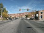
U.S. Highway 191 begins at the Canada border in Montana and covers 1905 miles, running north and south through the Rocky Mountains, ending at Douglas, Arizona on the Mexican border. It is broken into two branches, excluding the section through Yellowstone National Park.
In 1926, U.S. Highway ran only from Idaho Falls to Malta, Montana. In 1938 it was extended southward to Tremonton in Utah, but this section was decomissioned when Interstate 15 was completed along this route. In 1982, the section from West Yellowstone to Idaho Falls was decomissioned, since it duplicated U.S. Highway 20, and a new route was designated from Yellowstone down into southern Utah. In 1995, it was again extended through Arizona by renumbering route 666 to 191. The last extension to the route happened in 1999, from Malta to the Canadian border. U.S. Highway 191 is the last border-to-border route to be designated.
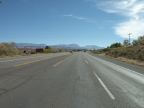
Along the route of U.S. Highway 191 lie Yellowstone National Park, Grand Teton National Park, Flaming Gorge National Recreation Area and Arches National Park. It also crosses the beautiful Uintah Mountains in northern Utah.
Here are the segments of U.S. Highway 191 which you can travel on UntraveledRoad:
| Where | Beginning | Ending |
| West Yellowstone | U.S. 287 Junction | Yellowstone Boundary |
| Teton N.P. | Moose Junction | Near Jackson |
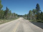
| Uinta Mountains | Flaming Gorge Dam | Vernal |
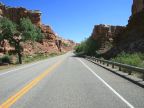
| Southeastern Utah | Utah Highway 131 | U.S. Highway 163 |
| Eastern Arizona | Near Alpine | Sanders |
| On the old alignment: | ||
| South Idaho/ North Utah | Downey, Idaho | Riverside, Utah |
For More Information
See the Wikipedia U.S. Highway 191 article.