Entry Points:

About U.S. Highway 89
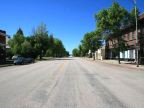
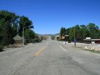
U. S. Highway 89 was commissioned in 1926 running from Yellowstone National Park in Wyoming, through the corner of Idaho, and the length of Utah and Arizona, ending on the Mexico border at Nogales, AZ. In 1934 it was extended through Montana, ending at Piegan on the Canadian border, for a total of 1685 miles. Interstate 19 in Arizona replaced the segment south of Flagstaff which was officially truncated in 1992. In Utah highway 89 follows the route of State Street, a highway established in pioneer times, from Brigham City to Manti. In Arizona it has an alternate route that begins at the Utah border, passes the north rim of the Grand Canyon, and meets the main route at Bitter Springs.
Highway 89 has no designated route through Yellowstone National Park, although it enters the park at Gardiner, Montana, and exits it through the South Entrance. To make the connection you would follow the Grand Loop Road to the South Entrance Road and head south out of the park.
What to See along Highway 89
U.S. Highway 89 passes through a variety of beautiful and dramatic scenery, many rural valleys, as well as the populous Wasatch Front in Utah. Here are a few samples of what you can see online of this route, both famous and little-known:
Yellowstone National Park
Yellowstone National Park was America's first national park and is one of the most famous natural wonders of the world, located in the northwest corner of Wyoming. Visit Old Faithful Geyser, Yellowstone Lake, Mammoth Hot Springs, Firehole Lake, the Artist's Paint Pots, Lone Star Geyser, Natural Bridge and many other lesser-known attractions.
The Grand Canyon
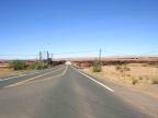
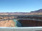
The alternate route U.S. Highway 89 in Arizona actually crosses the Grand Canyon on the Navajo Bridge, near the northern end of the canyon, and highway 89 and it's alternate skirt around the immense, mile-deep canyon from Kanab, Utah to Cameron, Arizona. The only access to the North Rim is by Arizona Highway 67 which begins at a junction with highway 89A at Jacob Lake. Arizona Highway 64 begins at Cameron and enters the park by its East Entrance.
The Vermilion Cliffs
Overlooking the desolate desert of House Rock Valley, the Vermilion Cliffs stand 1,500 feet tall, a wall of pink which U.S. Highway 89A skirts past for miles. In the year 2000 they became the Vermilion Cliffs National Monument. Hike to an old uranium mine in the cliffs themselves, or drive on the Paria Plateau above them.
Logan Canyon
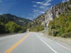
Highway 89 crosses through the Wasatch Mountains via Logan Canyon. With the surrounding peaks reaching over 10,000 feet, the high walls of Logan Canyon are covered in forests and cliffs and outcroppings of gray stone. The Logan River passes through the canyon. Hiking trails and campgrounds line the river.
Bear Lake Valley
Just across the mountains from Logan Canyon, Highway 89 reaches Bear Lake Valley. The twenty-mile long lake is noted for its blue color and is a recreational mecca for cities along Utah's Wasatch Front.
Tour Endpoints
Extensive sections of Highway 89 have been photographed for UntraveledRoad: Sheep Creek Gulch in the Grand Canyon of the Snake River (in Wyoming) to Logan, UT; near Sevier, UT to Kanab, UT; near Bitter Springs, AZ to near Gray Mountain, AZ; and the entire length of the alternate route in Arizona from the Utah border to Bitter Springs, AZ.
For More Information
See the Wikipedia U.S. Highway 89 article.