Entry Points:

About Vermilion Cliffs
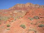
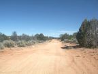
In the deserts of northern Arizona, the bright pink Vermilion Cliffs rise 1,400 feet above the scanty vegetation of House Rock Valley. Above the cliffs lies a juniper forest covering the Paria Plateau, a remote region stretching for miles to the north where it ends in a tumble of cliffs, canyons and rock formations.
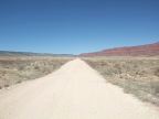
Vermilion Cliffs became a national monument on November 9, 2000, covering 294,000 acres. It is administered by the Bureau of Land Management, rather than the National Park Service. It is just a quiet and rugged reserve of dramatic landscape with no visitors center and few visitors.
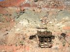
Indians inhabited the area for thousands of years and hundreds of indian ruins and petroglyphs can be found in the monument. Spanish explorers (the Dominguez-Escalante Expedition) visited the area in 1776. Mormon settlers explored the area in the 1860s. However, no permanent settlements were established and the land today is still much the same as it was hundreds of years ago.