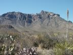
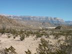
| The bright-colored peaks of the Chisos Mountains overlook the desert vegetation of Big Bend National Park. |
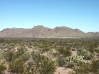
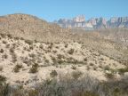
| Prickly pear cactus and creosotebush dominate this plain below Croton Peak. |
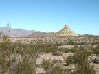
| A stone formation along state highway 118 |
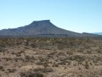
| Tule Mountain |
| A lechuguilla grows at the base of the Chisos Mountains. |
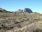
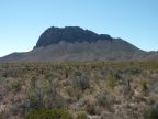
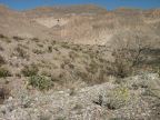
| Nugent Mountain, an outlier of the Chisos Mountains, is topped by high cliffs. |
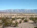
| The Sierra del Carmen with colored hills next to Tornillo Creek in the foreground |
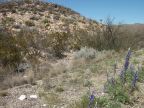
| Purple wildflowers grow along the road |
| The Mexican village of Boquillas sits below the cliffs of the Sierra del Carmen. |
| El Pico, a stone monolith that stands atop the Sierra del Carmen on the Mexican side of the river. |
| Yellow wildflowers grow along the road near the mouth of the Boquillas Canyon gorge. |
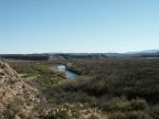
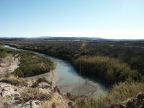
| The Rio Grande, forming the border between Texas and Mexico, flows through one of the few lowlands found in Big Bend National Park. |
| The Rio Grande |
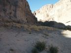
| Steep cliffs line Boquillas Canyon, through which the Rio Grande River flows after passing the Mexican village of Boquillas. |