Entry Points:

About Big Bend
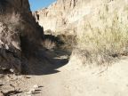
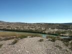
Named for the northward bend in the Rio Grande, on its way to the Gulf of Mexico, Big Bend National Park covers 801,163 acres of desert, mountains, and cliff-lined river gorges. The Rio Grande forms the southern boundary of the park, and is also the border between Mexico and the United States. In the center of the park, the Chisos Mountains rise high above the desert and harbor forests of juniper and pine trees.
Big Bend National Park was established June 12, 1944, and received 322,329 in 2002. Because of its remote and rugged location, it is one of the least-visited of the national parks and enjoys a greater solitude than most. An extensive network of dirt backroads opens up remote areas to the more adventurous visitors.
For More Information:
See the National Park Service's official Big Bend National Park site, or Wikipedia's Big Bend National Park article.