Entry Points:

About U.S. Highway 93
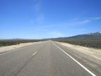
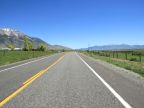
U.S. Highway runs north and south from Wickenburg, Arizona to the Canadian Border in Montana, a distance of 1457 miles. After passing through the deserts of Arizona, it crosses into Nevada next to Hoover Dam. In Nevada, its route passes through the wide, open valleys of the Great Basin region. In Idaho it descends into the Snake River Basin and then climbs into the Sawtooth Mountains. Continuing north from there it passes through a forested, mountainous region.
One alternate route (called 93A) separates from the main route at Lages Junction in Nevada, and heads up to Wendover on the Nevada-Utah border.
What to See along Highway 93
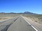
You can travel segments of Highway 93 in the UntraveledRoad tour in Nevada and Idaho. The Nevada segment runs from Lages Junction to Wells, Nevada. In Idaho, a segment of some 75 miles runs along the Lost River Mountains from Arco to Challis, and another bit is found at Shoshone, Idaho.
The Lost River Mountains
The Lost River Mountain Range includes Idaho's highest point, Mount Borah, at 12,662 feet in elevation. This dramatic range rises abruptly from the valley of the Big Lost River in a largely unbroken wall of towering mountain peaks which are snow-capped until late summer. Highway 93 cuts across the foothills right at their base.
Craters of the Moon National Monument
Craters of the Moon National Monument is home to a large lava field, craters, lava tube caves, cracks and other volcanic features in the Snake River Basin. Some of the lava flows appear so fresh that the discoverers swore that they were less than 100 years old. The landscape is so alien that it was named after the lunar landscape.
For More Information
See the Wikipedia U.S. Highway 93 article.