Entry Points:


About U.S. Highway 91
Today U.S. Highway 91 runs the short distance from Idaho Falls, Idaho to Brigham City, Utah, a distance of 120 miles. In the years 1947 to 1965, it extended from the Canadian border at Sweet Grass, Montana, to the Pacific Ocean at Redondo Beach. With the construction of Interstate 15, most of its length was decomissioned. The interstate took the shorter route of U.S. Highway 191 from Brigham City to McCammon, while Highway 91 passes through the more populated Cache Valley, some twenty miles to the east. From McCammon to Idaho Falls Interstate 15 either share the same route or are within a few miles of each other.
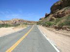
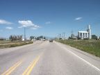
Most of U.S. Highway 91 passes through valleys of the Rocky Mountains. Idaho Falls is in the Snake River Basin, a vast plain occupying much of southern Idaho. U.S. Highway 91 travels southward from there to the mountains where it follows the Portneuf River through the Portneuf Gap into Marsh Valley. From there it crosses Red Rock Pass into Cache Valley. From there it crosses the Wasatch Mountains to end near Great Salt Lake.
UntraveledRoad includes the segment of U.S. Highway 91 from Preston to Downey, both in Idaho, and also segments in Logan and Smithfield in Utah. Also included are two portions of its old alignment from McCammon to Pocotello in Idaho, and Beaver Dam, AZ to Mesquite, NV.
For More Information
See the Wikipedia article on U.S. Highway 91.