Entry Points:

About U.S. Highway 50
U.S. Highway 50 runs 3,008 miles from Ocean City, Maryland to Sacramento, California. In between, it passes through Virginia, West Virginia, Ohio, Indiana, Illinois, Missouri, Kansas, Colorado, Utah and Nevada. It is one of the original routes designated in 1926 as part of the highway system, but has been changed several times. It used to extend all the way from the Atlantic Ocean to the Pacific Ocean, ending in San Francisco. This western section was replaced by interstate highways.
U.S. Highway 50 took in segments of older highways when it was created. It followed the Lincoln Highway in Nevada, the National Old Trails Road near the Colorado-Kansas border, and the Midland Trail in multiple places from Utah to Indiana.
U.S. Highway 50 is known as “the lonliest road in America” in Nevada, where it covers many miles visiting very few towns.
What to See along Highway 50
U.S. Highway 50 has been photographed from Ely, Nevada to where it joins Interstate 15 in central Utah, near Holden. In eastern Utah, Highway 50 has been moved onto Interstate 70, and the old highway is online from Green River to Fruita, with some missing sections that are not extant.
The Book Cliffs
The Book Cliffs lie on the north side of Highway 50 through the Grand Valley of Colorado and the deserts of eastern Utah. These brightly colored cliffs sports shades of yellow and blue and angular patterns and often resemble books on a shelf. Many primitive roads lead up into canyons opening into the cliffs. The is remote, but often visited by four-wheelers.
The San Rafael Swell
The Book Swell resulted from a dramatic fold in the earth’s crust, called the San Rafael Reef. To the west of the reef, the earth was raised up higher, and has been eroded into cliffs, pinnacles and other dramatic formations. Highway 50 joins Interstate 70 to make the climb up into the swell in a series of hairpin curves.
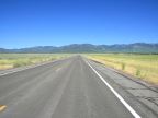
The Great Basin
Highway 50 passes through the Great Basin in Nevada, a large area where no river drains to the ocean. This area is characterized by wide desert valleys separated by tall mountain ranges. Great Basin National Park preserves part of the Snake River Range, where mountain peaks reach as high as 13,063 feet above sea level. These mountains are a beautiful alpine paradise, in spite of the arid conditions seen at their feet. Highway 50 crosses the Snake River Range, just to the north of the park.
For More Information
See the Wikipedia U.S. Highway 50 article.