Entry Points:

About U.S. Highway 180
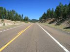
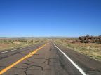
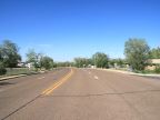
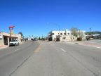
U.S. Highway 180 is an east-west route running from Weatherford, Texas to Valle, Arizona, a distance of 1092 miles. (A section of Arizona route 64 from Valle to the Grand Canyon has also been included as part of 180 at times.) The original route designated in 1926 ran from Weatherford to El Paso, Texas. It was extended eastward in 1940 to Handley, Texas, and westward in 1961 to Valle. With the completion of Interstate 20, it was truncated on the eastern end to Weatherford in 1991.
There is a short alternate route of Highway 180 in Arizona, stretching from the main route to Concho. U.S. Highway 180 used to go up to Concho, and then turn east, following roughly the route of State Highway 61 toward St. Johns. The route was shortened, bypassing Concho, with part of the old alignment being relagated to an alternate route.
What to See along Highway 180
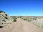
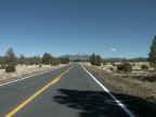
About 110 miles of Highway 180 have been photographed for UntraveledRoad in two segments in Arizona and New Mexico, from Valle to Flagstaff and from the Petrified Forest to the junction of New Mexico Highway 12. The alternate route, along with highway 61 and part of the original alignment near Concho are also available.
Grand Canyon National Park
Nothing surpasses the grandeur of the Grand Canyon, a short distance from the western terminus of Highway 180. A mile deep, miles wide, and 277 miles long, the Grand Canyon offsers sweeping, colorful vistas unparalleled anywhere in the world.
Petrified Forest National Park
Whether by flood, fire or natural causes, a great Jurrasic forest fell and was buried eons ago in what is now the deserts of Arizona. Erosion has once again uncovered these trees, now fossilized, and after its discovery in modern times it became known as the Petrified Forest. Park visitors view the trees today, petrified where they fell, laying in a desert setting among colored mounds of clay.
The San Francisco Peaks
The San Francisco Peaks reach above 12,000 feet in elevation, the highest elevation in Arizona. Arising from the arid Coconino Plateau, they are clad in evergreen forests and are often snow-capped. A maze of backcountry roads traverse their lower slopes, and the Snow Basin ski resort is perched on their southern face.
In Texas, U.S. Highway 180 also passes through the Guadalupe Mountains National Park, and next to Carlsbad Caverns National Park.
For More Information
See the Wikipedia U.S. Highway 180 article.