Entry Points:

About Historic Route 66
U.S. Highway 66 was commissioned in 1926, running 2,448 miles from Chicago to Los Angeles. At that time, only 800 miles of the road were paved, and it was in 1937 that the surfacing of the entire route was completed. Interstate routes gradually replaced sections of route 66 and it was officially decommissioned in 1985.
As one the earliest automobile routes across the west, route 66 has become symbolic of these early days of automobile travel. Small towns sprouted up all along the route, supplying the needs of motorists—gas, food and lodging—in a home-town, old-fashioned style arising from the rustic, do-it-yourself nature of the times.
John Steinbeck christened Route 66 "The Mother Road" in his novel The Grapes of Wrath, a nickname by which it is still called today. The decommissioning of the route in 1985 evoked a great deal of nostalgia, and most of the route is now marked as "Historic Route 66".
Due to realignments of the highway over the years, some sections have multiple routes, while other sections are not extant, having been torn up in the construction of Interstate routes.
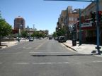
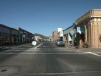
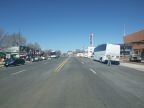
What to See along Historic Route 66
UntraveledRoad's virtual world allows you to travel significant portions of the old road. Currently these segments are available:
California’s Mojave Desert
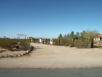
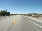
In southern California, route 66 passes through the Mojave Desert, an area of Joshua trees and cactus and little population. It is extant from near the Arizona border east of Needles to the west side of town. From there westward, the highway was torn up to build Interstate 40, but it reappears at the next interchange to the west, which is U.S. Highway 95. From here, highways 66 and 95 were combined up to the intersection with Goffs Road. From there you can continue west to a point west of Amboy. This part of the highway lies just south of the Mohave National Preserve.
Arizona
Beginning at Golden Shores, which is near the California border, follow route 66 as it climbs the Black Mountains to a point near Boundary Cone. On the other side of the mountains, it enters the Sacramento Valley and crosses it to reach Kingman on the other side. The next section that is available begins at Peach Springs and continues east to the Crookton Road Interchange. Eastward from there, highway 66 was torn up in building I-40 until an interchange west of Williams. From there, you can follow it to Grand Canyon Junction. Historic Route passes through the middle of Flagstaff, a short section of which is available.
New Mexico
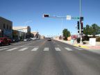
Two short sections of Historic Route 66 are online in New Mexico, as it passes through Albuquerque and Gallup, along with several miles east of Gallup.
For More Information
See the article on Historic Route 66 on Wikipedia.